

The first time I hiked the trail that skirts Devil’s Backbone, just west of Loveland, Colorado, my camera felt almost too small for the scene. The rock stretched for miles — a jagged, tilted wall that looked like some ancient beast’s spine rising from the foothills. Since then, I’ve returned again and again, chasing early light, dramatic clouds, and that quiet satisfaction that comes when a landscape slowly reveals its story.
Born From Ancient Seas and Mountain-Building
Long before the Rocky Mountains towered above Colorado, this land sat under shallow seas and braided rivers. Around 150–100 million years ago, sediment built up in those waters, forming sandstones and shales. Later, about 70 million years ago, the Laramide Orogeny — the same tectonic upheaval that raised the Rockies — pushed those layers upward and tipped them nearly on edge.
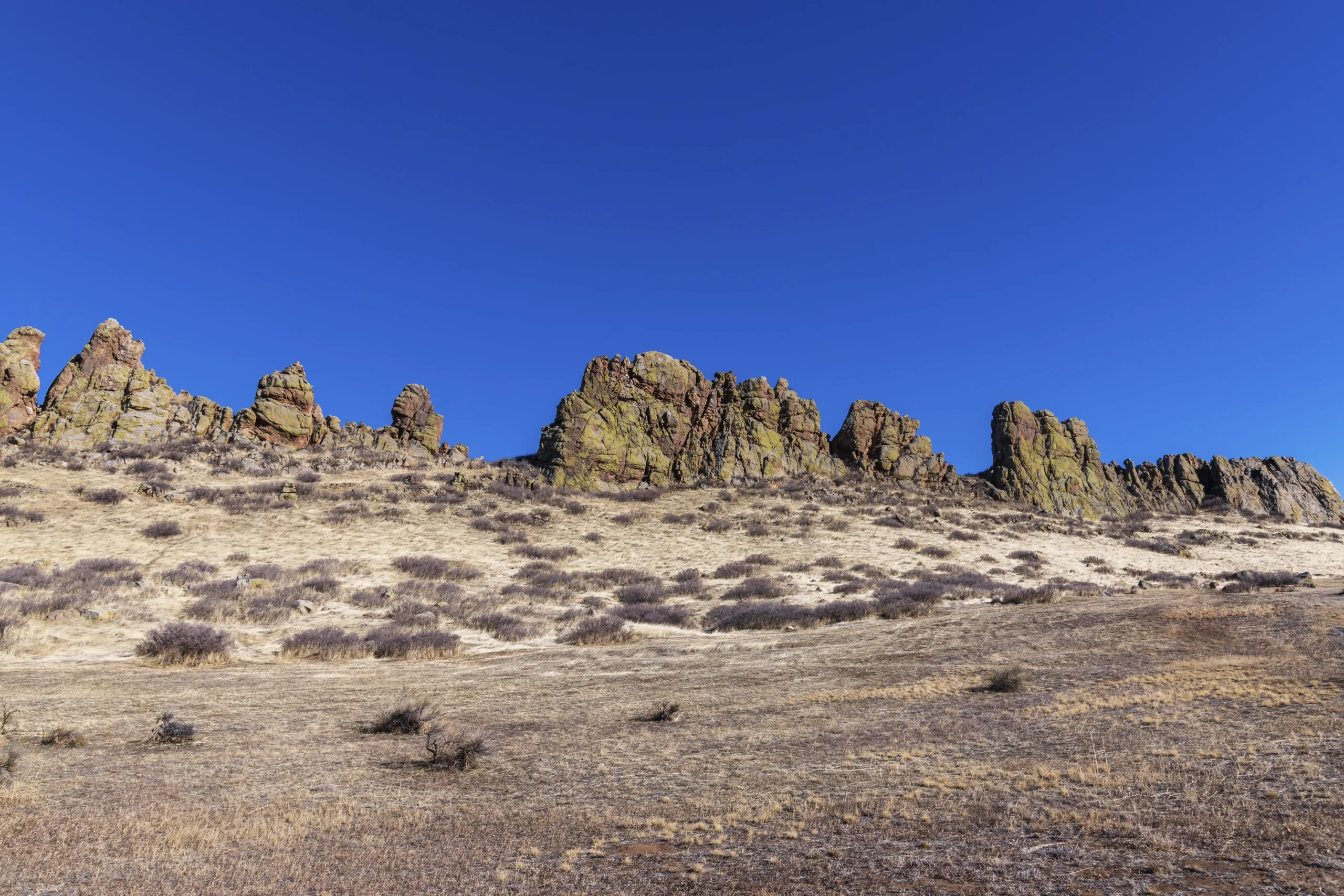
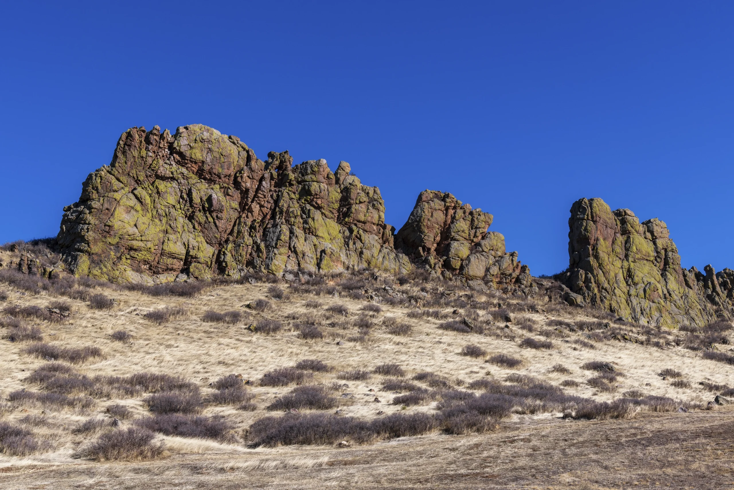
That uplift created the Dakota Sandstone Ridge we now call Devil’s Backbone. Iron-rich minerals stained the rock its warm golds and reds; erosion carved notches and arches, giving the ridge its “spinal” silhouette. When I photograph it at dawn, the light hits each jag and vertebra-like curve, and it feels alive — a fossilized wave of geologic energy caught mid-surge.
A Crossroads for Ancient Peoples
Archaeologists have found evidence of human presence here stretching back thousands of years. The Backbone sits at the edge of the Great Plains and the Rockies — a natural corridor where early hunter-gatherers traveled, hunted, and camped. Later, Ute and Arapaho peoples moved through this area seasonally, following game and weather.
I think of that when I’m on the trail before sunrise. The same silhouette that photographers love today once guided travelers across the prairie. It’s humbling to stand where people have paused for millennia.
Settlers, Ranchers, and the Road West
By the mid-1800s, as settlers pushed west, this dramatic ridge became a familiar landmark for wagon trains and homesteaders heading into the Big Thompson Valley. Ranchers grazed cattle nearby, and the backbone marked a boundary between fertile plains and rougher foothills.
Today, the City of Loveland and Larimer County protect much of this land as Devil’s Backbone Open Space, preserving both natural habitat and public access. What could have been subdivisions and private grazing land is now 2,198 acres of open space with over 17 miles of connected trails.
Life Along the Backbone
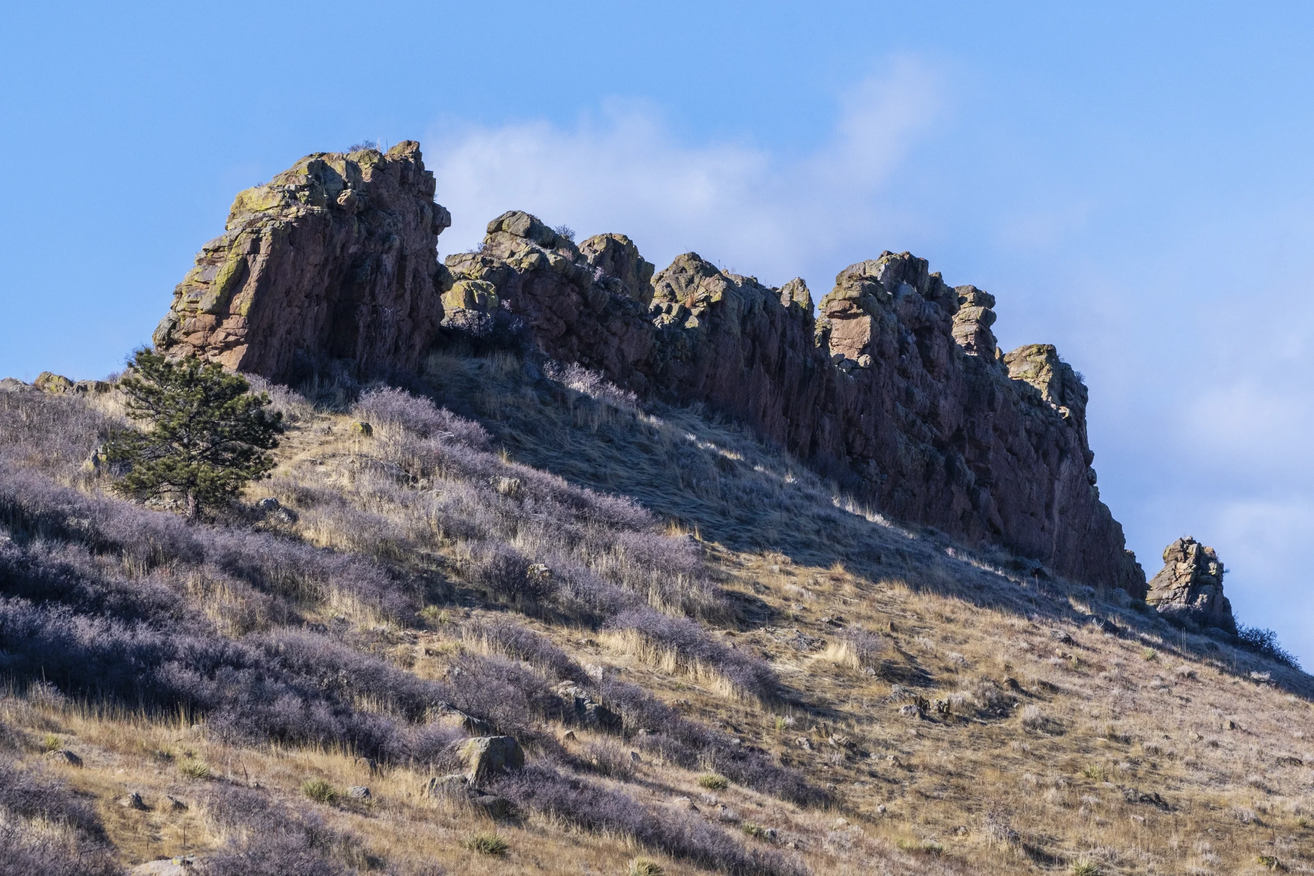
The environment here is a meeting ground — where prairie meets mountain and desert shrubs mix with ponderosa pines. You’ll find prickly pear cactus, yucca, and hardy junipers alongside cottonwoods along draws. Wildlife is just as varied: mule deer, coyotes, red foxes, and raptors like golden eagles and red-tailed hawks patrol the ridge.
For photographers, this edge ecosystem is a gift. In spring, wildflowers paint the hillsides. In autumn, low sun and turning grasses give the rocks a coppery glow. On lucky days, I’ve caught coyotes slipping through tall grass or a hawk perched against the sandstone skyline.
Conservation is an ongoing challenge. Heavy foot traffic and off-trail wandering can damage fragile soil and native plants. County land managers encourage visitors to stay on designated paths to keep the landscape healthy for wildlife and future hikers.
A Destination for Hikers and Dreamers
The Devil’s Backbone Trailhead sits just a few minutes from Loveland but feels worlds away. From there, the main trail winds up beside the rock spine, eventually linking to the Blue Sky Trail toward Fort Collins and the Coyote Ridge Natural Area. It’s part of a much larger Front Range trail network that mountain bikers, hikers, and trail runners love.
Popular stops include the Keyhole, a natural arch framing sweeping views toward the plains and Longs Peak on clear days. Sunrise through the Keyhole is one of my favorite photo moments — the arch glows orange while the plains stretch into shadow.
Unlike some heavily commercialized natural sites, Devil’s Backbone keeps things simple: dirt parking lot, trailhead kiosk, and wide-open sky. Entry is free. The payoff comes from walking, looking, and letting the place speak for itself.
Photographing the Backbone
For photographers, this landscape rewards patience and planning:
- Morning Light: The ridge faces east, so sunrise illuminates the rock spine while the plains stay cool and blue.
- Evening Drama: Sunsets often spark thunderheads or alpenglow over the Rockies, casting long shadows across the backbone.
- Telephoto Play: A long lens can compress the jagged ridge into striking abstract forms, while a wide angle captures its sweep against the sky.
- Seasonal Variety: Spring wildflowers, autumn grasses, and winter snow each change the scene’s color and feel.
I’ve learned to watch the weather here. Colorado’s Front Range can shift quickly; storm clouds make for dramatic images but also call for caution.
Why I Keep Returning
Some landscapes shout for attention; others whisper until you slow down and listen. Devil’s Backbone does both. Its serrated spine catches the eye from miles away, yet the longer you linger, the more it reveals — ancient sea beds turned mountain bones, the footsteps of travelers long gone, the play of light on stone and grass.
As a photographer learning to see more deeply, this place has been a teacher. It’s close enough for a day’s outing yet wild enough to feel untamed. Each visit reminds me why I chase landscapes: not just to capture them, but to understand the layers of time, story, and life they hold.
Visiting Tips
- Start early or late to beat crowds and catch the best light.
- Stay on marked trails — both to protect fragile habitat and to avoid rattlesnakes that sometimes bask off-path.
- Bring water and watch the weather, especially in summer when thunderstorms roll off the foothills.
- Pair your visit with nearby stops: Loveland’s art scene, Carter Lake, or Rocky Mountain National Park less than an hour away.
Final Frame
Every time I shoulder my camera and head up the Devil’s Backbone Trail, I feel connected to something enduring. This stone spine has witnessed seas, dinosaurs, hunters, ranchers, and now modern wanderers. Photographing it is more than capturing a pretty view; it’s entering a dialogue with time. And for anyone who loves landscape, history, and wild light, that’s an invitation worth accepting.
References and research
- Larimer County Natural Resources – Devil’s Backbone Open Space
- Geological Society of America – Front Range Uplift and Dakota Sandstone Geology
- Colorado Geological Survey – Geology of Devil’s Backbone
- US Forest Service – Laramide Orogeny and Front Range Geology
- National Park Service – Dakota Sandstone Formation Overview
- USGS – Dakota Sandstone and Cretaceous Seas of Colorado


